Showing and configuring tides and currents, Showing satellite imagery on the navigation chart, Viewing aerial photos of landmarks – Garmin GPSMAP 8530 Black Box User Manual
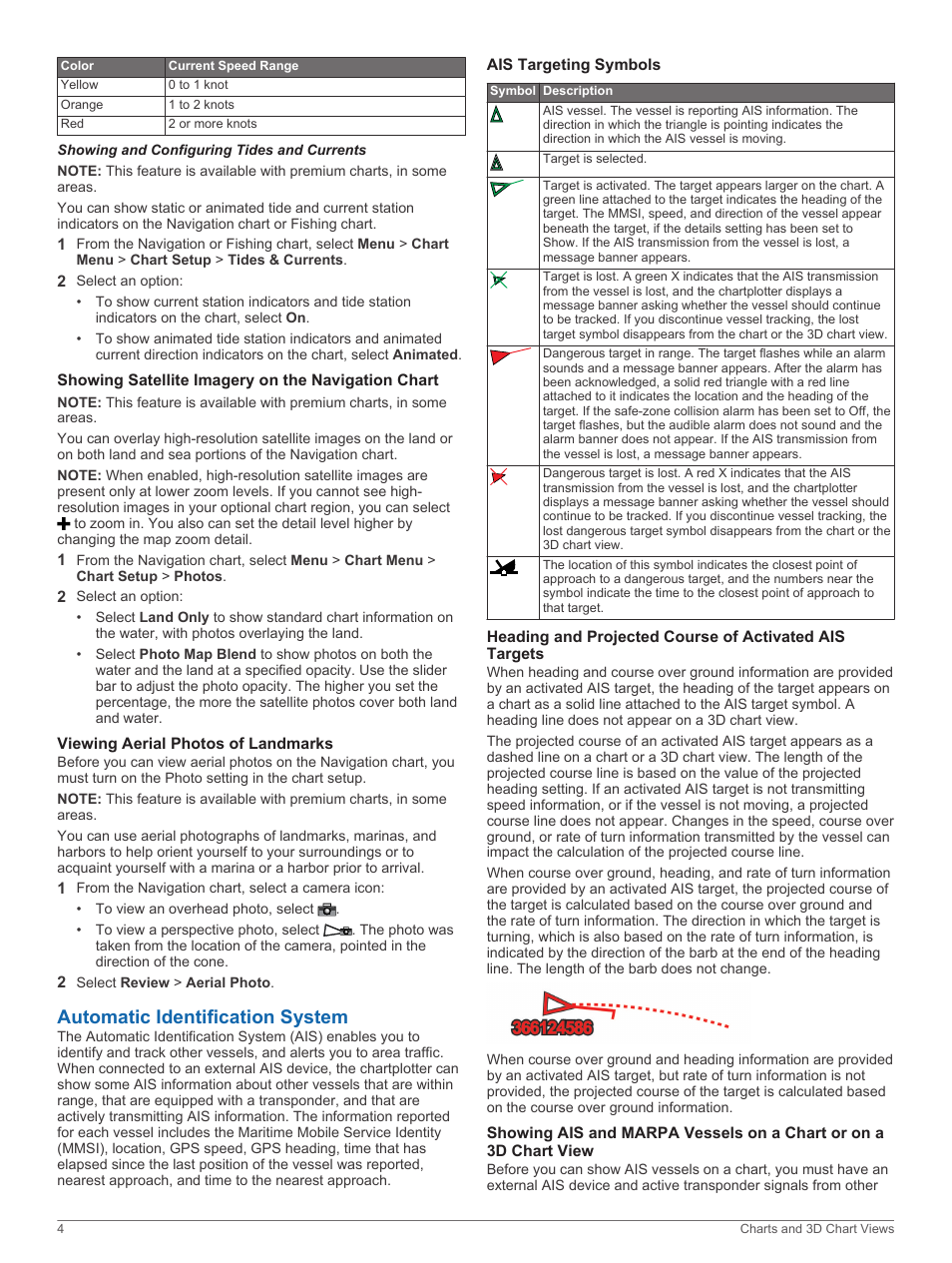
Page 10: Automatic identification system, Ais targeting symbols, The navigation chart, Surroundings