GLOBALSAT ET-314 GPS Engine Board User Manual
Page 10
ET-314AC
High Performance GPS Engine Board
2010/4/1
- 10 -
Note –
A valid status is derived from all the parameters set in the software. This includes the
minimum number of satellites required, any DOP mask setting, presence of DGPS corrections,
etc. If the default or current software setting requires that a factor is met, then if that factor is not
met the solution will be marked as invalid.
GLL - Geographic Position-Latitude/Longitude
Note – Fields marked in italic
red
apply only to NMEA version 2.3 (and later) in this NMEA
message description
Table A-3 contains the values for the following example:
$GPGLL,3723.2475,N,12158.3416,W,161229.487,A,A*41
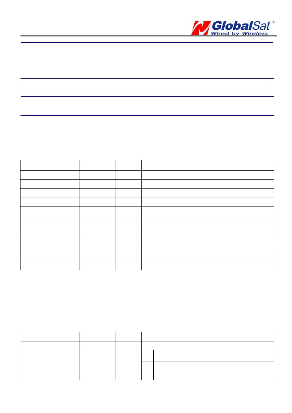
Table A-3 GLL Data Format
Name Example
Units
Description
Message ID
$GPGLL
GLL protocol header
Latitude 3723.2475
ddmm.mmmm
N/S Indicator
n
N=north or S=south
Longitude
12158.3416
dddmm.mmmm
E/W Indicator
W
E=east or W=west
UTC Position
161229.487
hhmmss.sss
Status A
A=data
valid or V=data not valid
Mode
A
A=Autonomous, D=DGPS, E=DR
N=Output Data Not Valid
Checksum *41
End of message termination
GSA - GNSS DOP and Active Satellites
Table A-4 contains the values for the following example:
$GPGSA,A,3,07,02,26,27,09,04,15,,,,,,1.8,1.0,1.5*33
Table A-4 GSA Data Format
Name Example
Units
Description
Message ID
$GPGSA
GSA protocol header
M Manual-forced to operate in 2D or 3D mode
Mode 1
A
A
2Dautomatic-allowed to automatically switch
2D/3D