Glossary – Uniden TRAX350 User Manual
Page 113
Page 113
How Do I Use It?
Track Logs
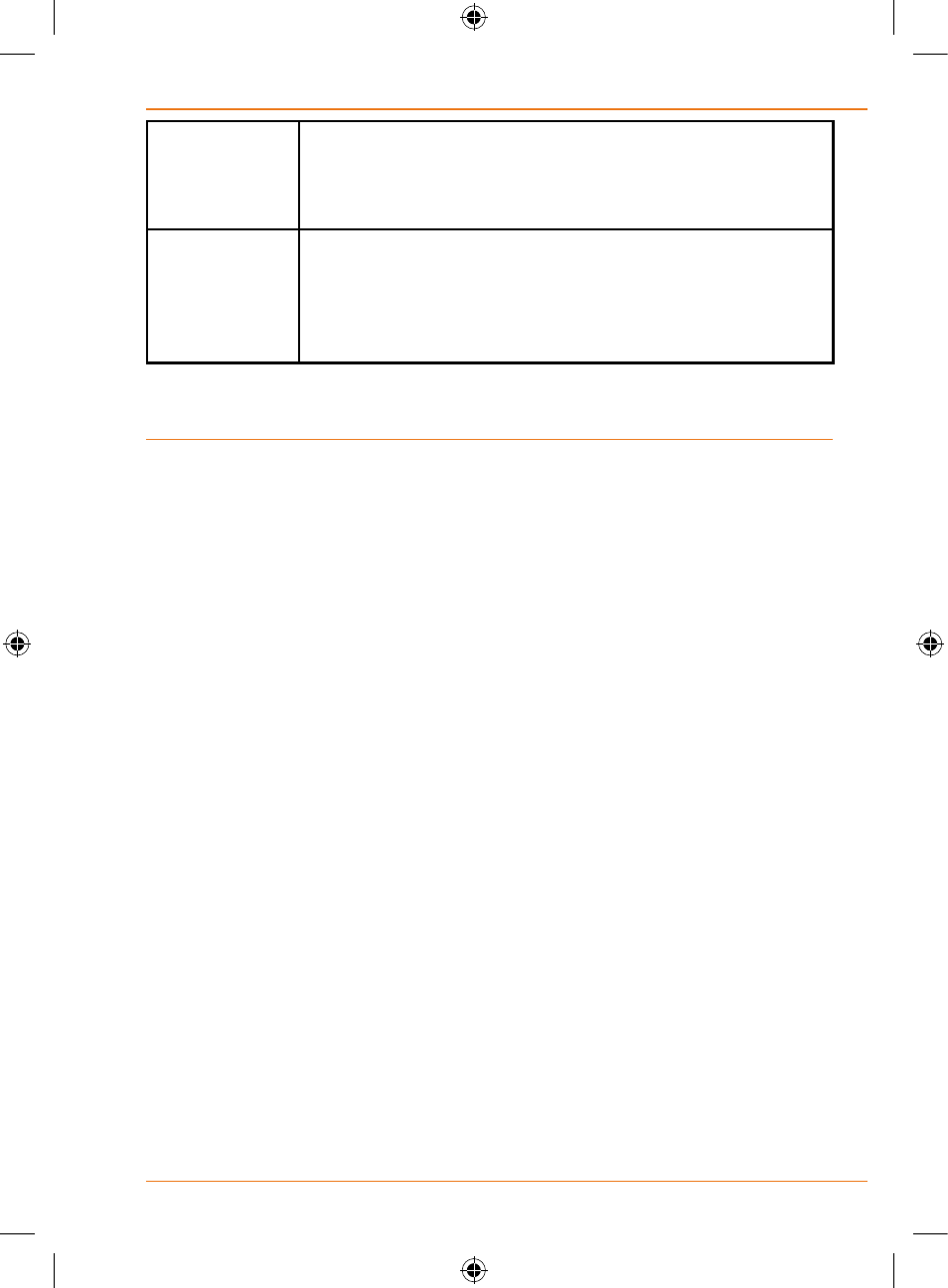
Max. Size
You can set the maximum database size for the
automatically saved track logs. When the limit is
reached, the oldest automatically saved track logs will
be deleted.
Create NMEA/
SIRF Log
Independently of the normal track log, you can instruct
TRAX350 to record the native GPS data received from
the GPS device. These logs are saved as separate text
files on the internal Flash ROM, and they cannot be
shown or replayed in TRAX350.
5: Glossary
2D/3D GPS reception
The GPS receiver uses satellite signals to calculate its (your) position and
need at least four signals to give a three-dimensional position, including
elevation. Because the satellites are moving and because objects can
block the signals, your GPS device might not receive four signals. If three
satellites are available, the receiver can calculate the horizontal GPS
position but the accuracy is lower and the GPS device does not give you
elevation data: only 2D reception is possible.
Active route
The currently navigated route. You can save and load routes in TRAX350,
but only one route can be active at any given time, and it is always active
until you delete it, reach your destination or you quit TRAX350. See also:
Route.
City Centre
The City Centre is not the geometric centre of the settlement but an
arbitrary point the map creators have chosen. In towns and villages, it is
usually the most important intersection; in larger cities, it is an important
intersection.
GPS accuracy
Several factors have impact on the deviation between your real position
and the one given by the GPS device. For example, signal delay in the
ionosphere or reflecting objects near the GPS device have a different
and varying impact on how accurately the GPS device can calculate your
position.