Unit capabilities, Water depth, Water temperature – Garmin 160C User Manual
Page 15: Speed, Distance, Thermocline and structure, Bottom shape and type
Fishfinder 160C Owner’s Manual
11
O
PERATING
I
NSTRUCTIONS
>
U
NIT
C
APABILITIES
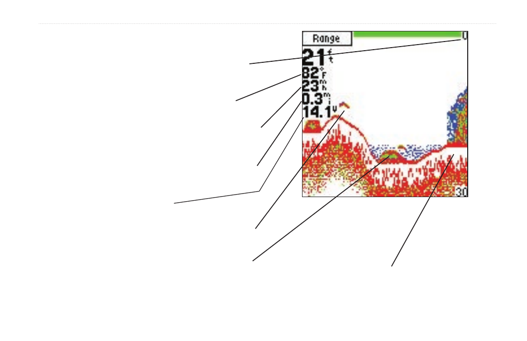
Unit Capabilities
Water Depth
The Depth Scale is displayed from top to bottom along the right
side. Messages and Alarm Icons are displayed along the bottom.
Water Temperature
The unit can display the water temperature at the transducer.
Speed
Speed can be displayed in miles per hour, kilometers per hour, and
knots. A speed capable transducer is required.
Distance
Distance can be displayed in miles, nautical miles, or kilometers. A
speed capable transducer is required.
Battery Voltage
Current battery voltage can be displayed.
Fish
The unit displays fish as arches or fish symbols in three sizes and
can alert you when a fish is detected.
Thermocline and Structure
Garmin’s See-Thru technology can display more than just the
thermocline and structure, the unit displays fish in and below the
thermocline, trees, brush, and deadfall.
Bottom Shape and Type
Garmin’s Auto Gain system provides a clear graphic representation
of the bottom type and its shape.
(Simulated display)