35 navigation data, 1 navigation data during standby, Lat lon – Furuno FR-8122 EN User Manual
Page 59
1. OPERATIONAL OVERVIEW
1-45
1.35
Navigation Data
1.35.1
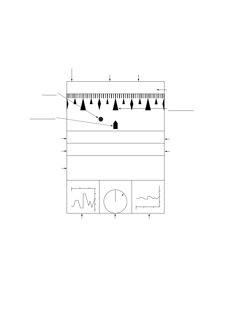
Navigation data during standby
Navigation data is shown in standby when STBY Mode Display in the Initial Menu is set to “Nav”.
Appropriate sensors required to display data.
Navigation data display at standby
Time until Tx in watchman
(Displayed when watchman is active.)
Heading indicator
Graphic appears even
if bearing signal is lost,
however the compass
point indications do not
appear.
Standby indication
Own ship marker
Fixed regardless
of ship's movement.
Heading
Cross-track
error
Waypoint
Flashes if
vessel goes
outside display
bearing.
Speed
Date
Position
Depth
Wind speed
and direction
Water
temperature
Time
24/JAN/2006
DATE
SPEED
COURSE
POSITION
N
NNE
NE
E
NNW
NW
W
HEADING
LAT
LON
90
°
00.000 N
180
°
00.000 E
12.9
kts
359.9
°
TIME
23 : 59 : 59
XTE
←
9.99nm 359.9
°
STBY
20
40
80
60
DEPTH
(m)
30
30
20
0
10
TEMP 18.3
(
°
C)
40.3
20
10
20
10
WIND
65.3
(kt)
45.0
°
(R)
N
(min)
30
0
(min)
Course