Holux – Holux GR-213 User Manual
Page 11
HOLUX
11
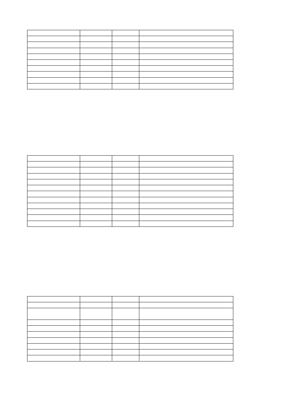
Latitude 3723.2475
ddmm.mmmm
N/S Indicator
N
N=north or S=south
Longitude 12158.3416
dddmm.mmmm
E/W Indicator
W
E=east or W=west
Speed Over Ground
0.13
knots
Course Over Ground
309.62
degrees True
Date 120598
ddmmyy
Magnetic Variation(1)
degrees E=east or W=west
Checksum *10
End of message termination
1. SiRF Technology Inc. does not support magnetic declination. All “course over ground” data are geodetic
WGS84 directions.
5.1.6 Course Over Ground and Ground Speed (VTG)
Table 5-10 contains the values for the following example:
$GPVTG,309.62,T, ,M,0.13,N,0.2,K*6E
Table 5-10 VTG Data Format
Name Example
Units
Description
Message ID
$GPVTG
VTG protocol header
Course 309.62
degrees
Measured
heading
Reference T
True
Course
degrees
Measured
heading
Reference M
Magnetic(1)
Speed
0.13
knots
Measured horizontal speed
Units N
Knots
Speed
0.2
km/hr
Measured horizontal speed
Units
K
Kilometers per hour
Checksum *6E
End of message termination
1. SiRF Technology Inc. does not support magnetic declination. All “course over ground” data are geodetic
WGS84 directions.
5.1.7 ZDA—SiRF Timing Message
Outputs the time associated with the current 1 PPS pulse. Each message will be output within a few
hundred ms after the 1 PPS pulse is output and will tell the time of the pulse that just occurred.
Table 5-11 contains the values for the following example:
$GPZDA,181813,14,10,2003,00,00*4F
Table 5-11 ZDA Data Format
Name Example
Units
Description
Message ID
$GPZDA
ZDA protocol header
UTC Time
181813
Either using valid IONO/UTC or estimated
from default leap seconds
Day
14
01 TO 31
Month
10
01 TO 12
Year
2003
1980 to 2079
Local zone hour
00
knots
Offset from UTC (set to 00)
Local zone hour
00
Offset from UTC (set to 00)
Checksum 4F
End of message termination