For "text information in map, Comand, Navigation – Mercedes-Benz S-Class 2011 User Manual
Page 184
interest are, for example, gas stations, hotels,
cinemas and restaurants.
The following settings are possible:
R
Standard Symbols
Icon display determined by the factory
settings
R
Personal Symbols
You can determine the icons yourself
R
No Symbols
No icons are shown on the map.
X
To show the menu: press the COMAND
controller W.
X
Select
Navi
in the main function bar by
sliding ZV and turning cVd the COMAND
controller and press W to confirm.
X
Select
POI Symbols on Map
and press
W to confirm.
X
Select
Standard Symbols
,
Personal
Symbols
or
No Symbols
.
If you select
Personal Symbols
, the list of
points of interest appears.
X
To switch the icon display on/off: select
the point of interest by turning cVd the
COMAND controller and press W to
confirm.
Depending on the previous setting, the
icons will be switched on O or off ª. You
can switch on the icon displays for more
than one point of interest.
i
The list shows all icons that are contained
on the digital map across all countries.
However, not all points of interest are
available in all countries. As a result, certain
point of interest icons may not be displayed
on the map, even if the icon display is
switched on.
X
To exit the menu: press the % back
button.
Map information in the display
Displaying text messages
During route guidance, you can have map
information displayed at the bottom edge of
the display.
X
To show the menu: press the COMAND
controller W.
X
Select
Navi
in the main function bar by
sliding ZV and turning cVd the COMAND
controller and press W to confirm.
The main area is active.
X
Select
Navi
again and press W to confirm.
The navigation menu opens.
X
Select
Text Information on Map
and
press W to confirm.
The # dot indicates the current setting.
X
Select
Arrival Time/Distance
,
Current Street
,
Geo Coordinates
or
None
, and press W to confirm.
X
To exit the menu: slide XVY the COMAND
controller.
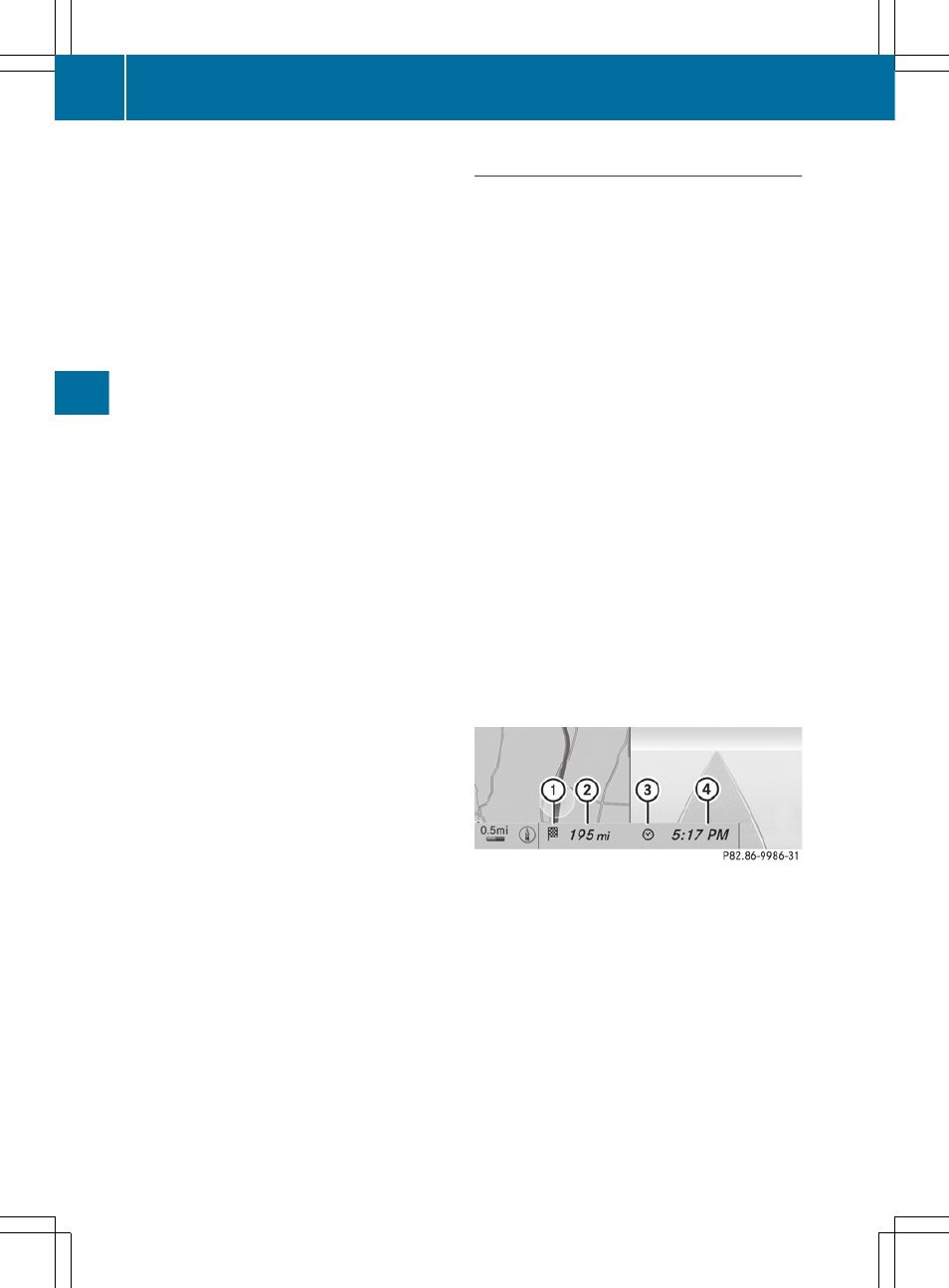
Arrival time/distance to the destination
Arrival time/distance display switched on
:
Icon for destination
;
Distance to destination
=
Icon for estimated time of arrival
?
Estimated time of arrival
You can only see this display during route
guidance. When scrolling the map
(
page 158), you will see data, e.g. road
names, depending on the crosshair position
if the digital map supports this data.
182
Navigation
COMAND