Enhanced lake maps – Lowrance electronic iWAY 600C User Manual
Page 78
72
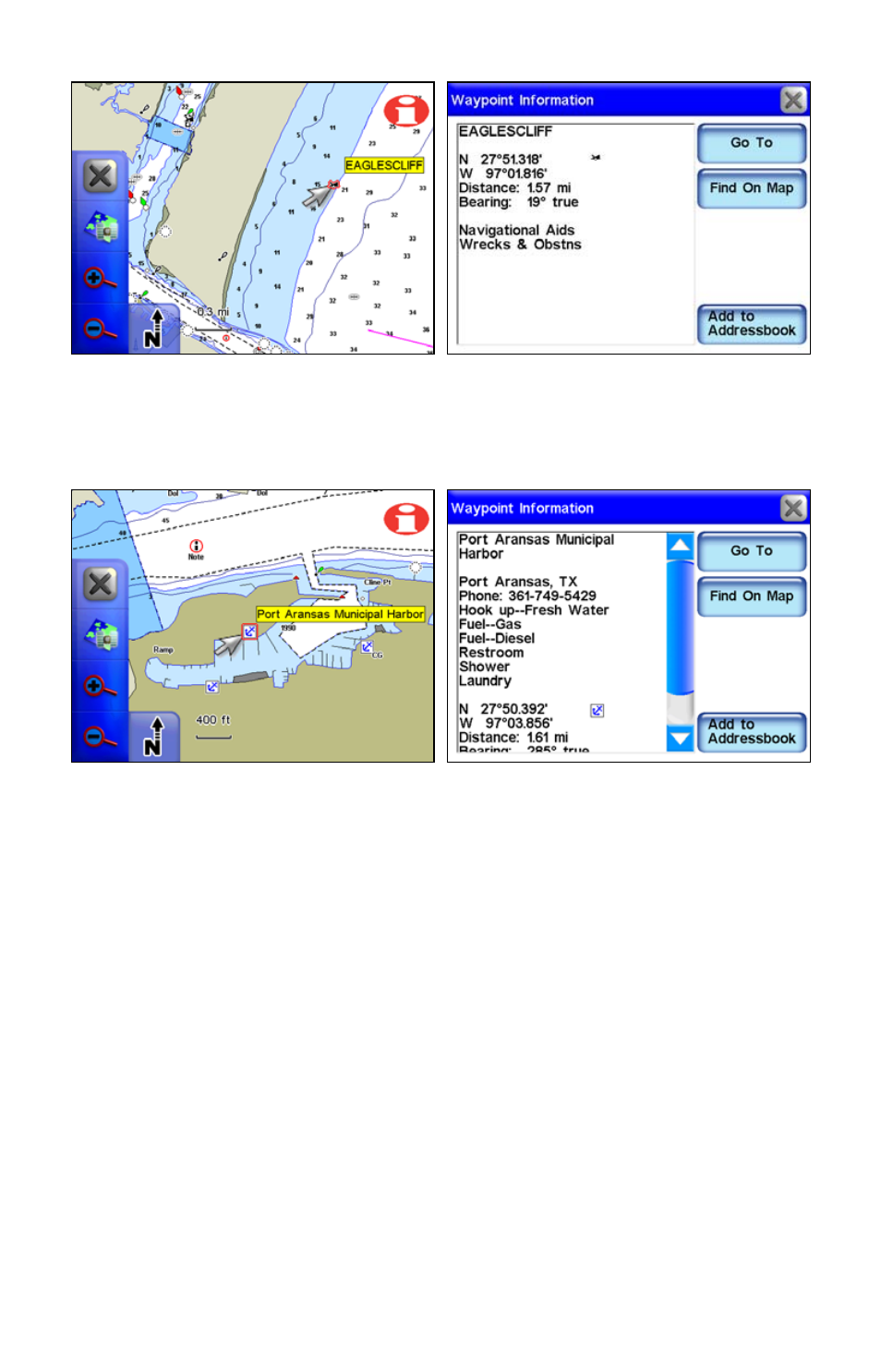
The cursor has been used to highlight a shipwreck symbol, and a
popup box appeared describing the selected item. The Information
button was then selected to view waypoint information on the wreck.
The cursor has selected the Port Aransas Municipal Harbor marina
symbol. In the right figure the Information button has been selected to
view information on the marina, including available amenities.
Enhanced Lake Maps
The Standard map data is based on our MapCreate series 7 software
which covers all 50 states in the U.S.A. The data includes land-based
topographic contour lines, public hunting areas and depth contours for
more than 3,000 U.S. inland lakes.
See also other documents in the category Lowrance electronic GPS receiver:
- 200 (61 pages)
- 3200 (128 pages)
- IFINDER PRO (132 pages)
- X107CDF (92 pages)
- 988-0161-011 (60 pages)
- Lowrance GlobalMap 9300C HD (168 pages)
- 500 (132 pages)
- Nautic Insight HDS-5m (48 pages)
- Lowrance GlobalMap 6600C HD (144 pages)
- Lowrance iWAY 250C (76 pages)
- Handheld Mapping GPS Receiver (140 pages)
- LMS 330C (216 pages)
- GlobalMap 4800M (132 pages)
- GlobalMap 1600 (92 pages)
- Lowrance GlobalMap Baja 480C (140 pages)
- LMS-339cDF iGPS (204 pages)
- X96TX (84 pages)
- 4900M (136 pages)
- HD LCX-110C (208 pages)
- Lowrance iFINDER GO (16 pages)
- Lowrance iFINDER H2O C (132 pages)
- iFINDER H2O (124 pages)
- Lowrance GlobalMap 3500C (136 pages)
- 3600C (136 pages)
- 310 (65 pages)
- LMS-525C DF (252 pages)
- LMS-332C (216 pages)
- H2O (124 pages)
- Lowrance iFINDER Hunt (160 pages)
- AirMap 600c (152 pages)
- 100M (68 pages)
- Lowrance LMS-527cDF iGPS (252 pages)
- AirMap 500 (132 pages)
- X86 DS (56 pages)
- LCX-16CI (76 pages)
- Lowrance iFINDER Pro (132 pages)
- M68C S/Map (176 pages)
- 6 (108 pages)
- AirMap 1000 (148 pages)
- 12 (58 pages)
- 480C (140 pages)
- Lowrance GlobalMap 5500C (136 pages)
- 4000M (128 pages)
- iFINDER M-M (116 pages)
- Lowrance iFINDER Explorer (140 pages)