Lowrance electronic LCX-104C User Manual
Lcx-104c, Operation instructions, Fish-finding sonar & mapping gps
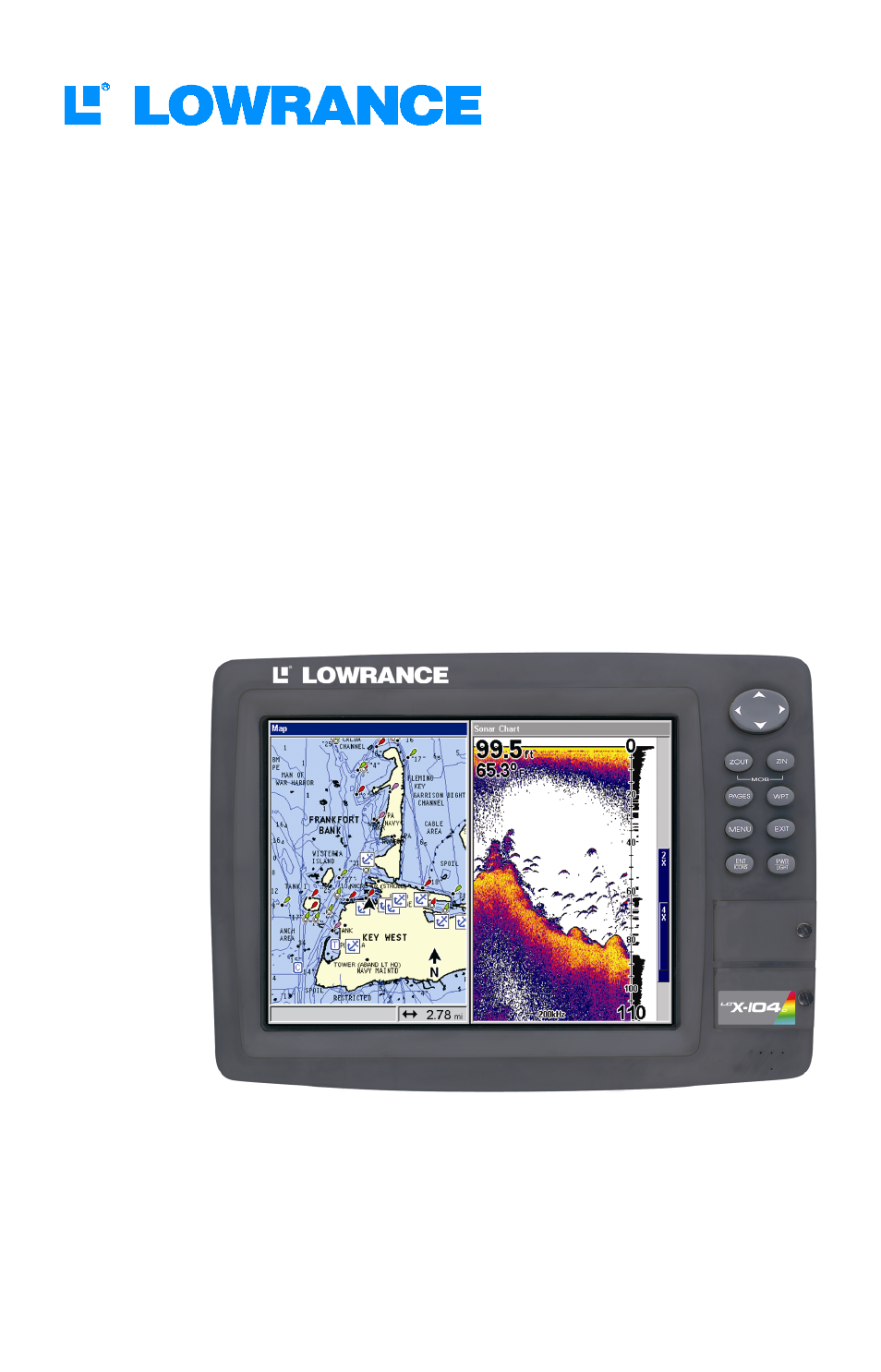
Table of contents
Document Outline
- Cover
- Inside Cover
- Table of Contents
- Sec. 1: Read Me First!
- Sec. 2: Installation & Accessories
- Sec. 3: Basic Sonar Operation
- Sec. 4: Sonar Options & Other Features
- 53. ASP™ (Advanced Signal Processing)
- 54. Alarms
- 56. Calibrate Speed
- 57. Chart Speed
- 58. ColorLine™
- 60. Depth Cursor
- 60. Depth Range - Automatic
- 61. Depth Range - Manual
- 61. Depth Range - Upper and Lower Limits
- 63. FasTrack™
- 63. Fish I.D.™ (Fish Symbols & Depths)
- 65. FishTrack™
- 65. Frequency (Change Transducer Frequency)
- 66. HyperScroll™
- 66. Log Sonar Chart Data
- 67. Noise Rejection
- 67. Overlay Data
- 69. Ping Speed & HyperScroll™
- 71. Reset Options
- 71. Reset Water Distance
- 72. Set Keel Offset
- 73. Sensitivity & Auto Sensitivity
- 74. Sonar Color Mode
- 75. Sonar Page & Sonar Chart Display Options
- 80. Sonar Simulator
- 83. Stop Chart
- 83. Surface Clarity
- 84. Upper and Lower Limits
- 84. Zoom & Zoom Bar
- 85. Zoom Pan
- Sec. 5: Sonar Troubleshooting
- Sec. 6: Basic GPS Operations
- 91. Keyboard
- 92. Power/Lights on and off
- 92. Main Menu
- 94. Pages
- 103. GPS Quick Reference
- 104. Find Your Current Position
- 104. Moving Around the Map: Zoom & Cursor Arrow Keys
- 105. Selecting Any Map Item With the Cursor
- 105. Searching
- 107. Set a Waypoint
- 109. Navigate To a Waypoint
- 110. Set Man Overboard (MOB) Waypoint
- 110. Navigate Back to MOB Waypoint
- 111. Navigate to Cursor Position on Map
- 113. Navigate to a Point of Interest
- 113. Creating and Saving a Trail
- 115. Displaying a Saved Trail
- 115. Navigating Trails
- 119. Transfer Custom Maps and GPS Data Files
- 121. Cancel Navigation
- Sec. 7: Advanced GPS Operations
- Sec. 8: System & GPS Setup Options
- 135. Alarms
- 136. Auto Satellite Search
- 137. Check MMC Files and Storage Space
- 137. Communications Port Configuration
- 138. Configure DGPS
- 139. Configure NMEA
- 139. Coordinate System Selection
- 140. Map Fix
- 142. Customize Page Displays
- 142. DGPS Status
- 142. GPS Simulator
- 144. Hide GPS Features
- 144. Initialize GPS
- 145. Map Auto Zoom
- 145. Map Data
- 147. Map Datum Selection
- 147. Map Detail Category Selection
- 148. Map Orientation
- 149. Overlay Data
- 151. Navionics® Charts
- 156. Pop-up Help
- 157. Position Pinning
- 157. Reset Options
- 158. Require DGPS
- 158. Screen Contrast and Brightness
- 159. Set Language
- 160. Set Local Time
- 160. Show WAAS Alarm
- 161. Software Version Information
- 161. Sounds and Alarm Sound Styles
- 162. Track Smoothing
- 162. Trail Options
- 165. Units of Measure
- Sec. 9: Searching
- Sec. 10: Supplemental Material
- Back